
Virginia Eastern Shore
Introduction
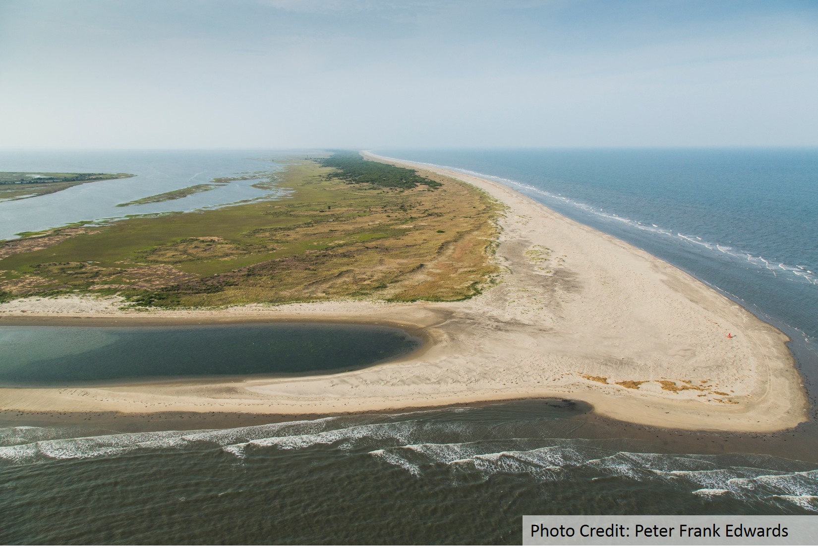
On Virginia’s Eastern Shore—a narrow peninsula that separates the Chesapeake Bay from the Atlantic Ocean—lies the longest coastal wilderness remaining on the U.S. Atlantic Seaboard. Some 60 miles of undeveloped barrier islands are a refuge for hundreds of species of plant and animal life and a mecca for migratory songbirds, raptors, and shorebirds. This iconic wilderness has come to define the local culture and economy. Visitors are greeted with signs proclaiming: “You’ll Love Our Nature.”
It follows that the natural riches of the Virginia’s Eastern Shore make it an important economic engine for the Mid-Atlantic region.
Fishermen, duck hunters, birders, kayakers, and beachcombers flock to its idyllic shores. The Chincoteague National Wildlife Refuge located on Assateague Island is visited by 1.2-1.4 million tourists annually, making it one of the most heavily visited refuges in the US, generating millions of US dollars in spending and creates thousands of jobs for residents living in the Town of Chincoteague and surrounding villages. Because of the clean water in the tidal creeks and bays, the Virginia Eastern Shore is home to the U.S’s largest clam aquaculture industry with an average annual economic impact of $60 million USD. The rural coastal landscape is the ideal location for one of NASA’s premier rocket launch facilities, Wallops Flight Facility, with over $1 billion of mission-critical infrastructure located on Wallops Island, the only developed barrier island on the Virginia coast.

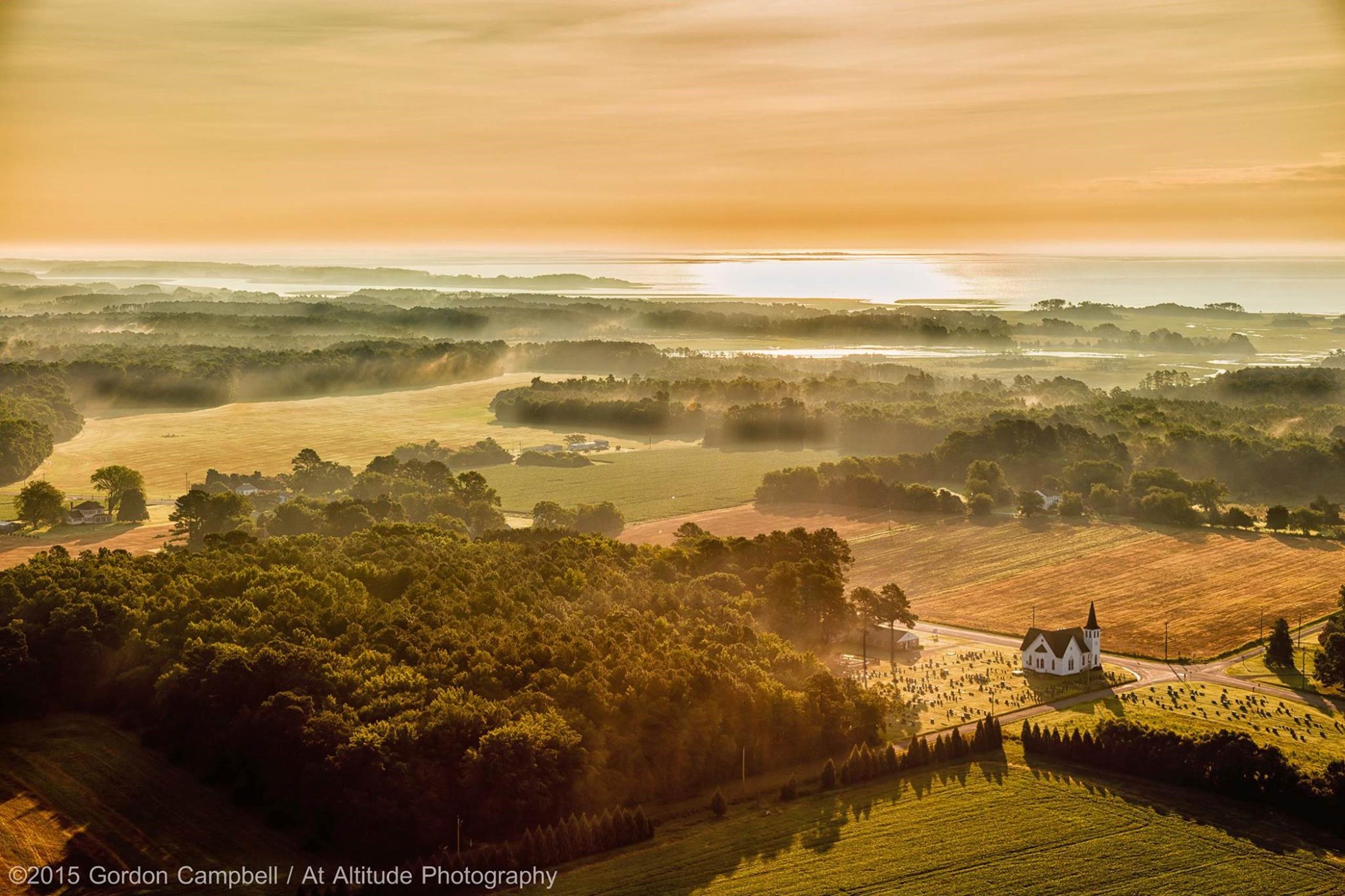
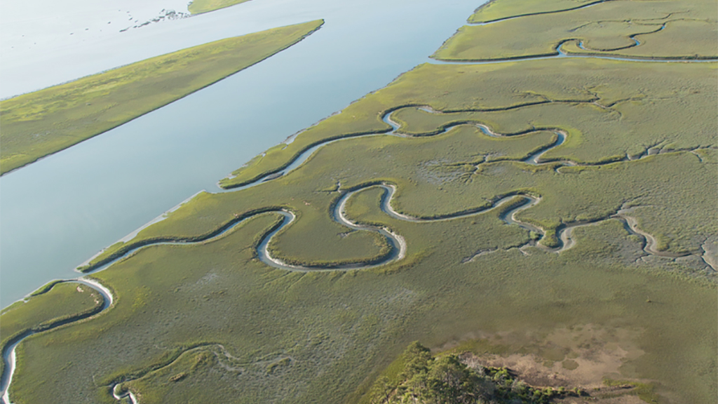
A typical tidal creek on the Atlantic side of the Eastern Shore where clam aquaculture beds thrive alongside agriculture. Photo Credit: 2015 Gordon Campbell / At Altitude Gallery
Moreover, the Eastern Shore hosts one of the National Science Foundation’s prestigious Long-Term Ecological Research (LTER) program sites, the Virginia Coast Reserve, operated by the University of Virginia, which has transformed the region into a center for world-class coastal science research for nearly 30 years.
The region’s way of life and economy relies on the peoples’ dependence on nature as a defense in the face of rising seas and extreme storms. The Eastern Shore lies within one of the U.S’s most vulnerable coastal regions. Sea levels are rising at three to four times the global average and storms are intensifying. Tens of millions of dollars have been spent in the past on piecemeal, reactive approaches to these mounting hazards. Often, engineered infrastructure solutions such as sea walls, groins and jetties have only exacerbated the area’s vulnerability.
The Nature Conservancy is working with leading coastal scientists and community partners to explore and document the resilience inherent in this natural system. We are using this living laboratory to better understand how nature can make coastal communities here—and everywhere—more resilient in the face of a changing climate. This information is being incorporated into the Coastal Resilience decision support tool, providing local governments with the information they need to better plan for the future.
Please email us at vacoastalresilience@tnc.org with questions and feedback.
LAUNCH the NEW Virginia Eastern Shore Mapping and Decision Support Tool

Rising sea level and eroding shoreline in Greenbackville, Virginia. Photo Credit: Gwynn Crichton/The Nature Conservancy
Climate change within this vast expanse of local communities living within this naturally functioning barrier island ecosystem is expected to drive a combination of extreme weather and sea-level rise that will increase the risk of coastal erosion, flooding, and the permanent inundation of what is now normally dry land. Current projections from the Virginia Institute of Marine Science’s Center for Coastal Resource Management regarding relative sea-level rise rates on Virginia’s Eastern Shore show a mean sea level rise of between 4.5 to 7 feet by 2100 which is three to four times the global average.
On the Eastern Shore, tens of millions of dollars have been spent on traditional “gray” infrastructure approaches, such as sea walls, groins, jetties, bulkheads and revetments, as defenses against mounting coastal hazards. Often, the gray infrastructure has only exacerbated the area’s vulnerability and undermined the region’s abundant natural resilience by interrupting critical environmental processes.
The impulse to harden shorelines to halt coastal erosion is driven, in part, by the lack of a public understanding and subsequent appreciation for the capacity of nature to mitigate the impacts of rising seas and extreme storms. The widespread use of gray infrastructure is also perpetuated by consultants, contractors, and government agencies whose expertise is often limited to traditional shoreline armoring for the single purpose of protecting property, buildings, homes, roads, and critical facilities. Without understanding the effectiveness of natural systems to provide equal protection with multiple benefits, coastal communities end up with hardened shorelines that eventually degrade the ecosystem and increase risk.

Shoreline armoring along Chesapeake Bay on Virginia’s Eastern Shore. Photo credit: Barry Truitt
The goal of our coastal resilience work is to make the case to local governments, contractors, and citizens that coastal ecosystems are nature’s first line of defense against shoreline erosion, flooding, and inundation. We also want to promote the recognition that these ecosystems provide other essential services, filtering water, sequestering carbon, ensuring the productivity of fish and shellfish, and increasing biodiversity—that are diminished or lost with traditional gray infrastructure solutions.
Read more about shellfish, saltmarshes, seagrass, and other habitats that provide nature based solutions.

Fowling Point at sunrise, east of Red Bank, Virginia. Photo © 2015 Gordon Campbell / At Altitude Gallery
The Coastal Resilience approach to mitigating the effects of climate change on Virginia’s Eastern Shore and in coastal communities around the world is to catalyze the adoption of nature-based solutions. The abundance of protected coastal wilderness on Virginia’s Eastern Shore offers the ideal place in Virginia to demonstrate and learn about the capacity of natural infrastructure to mitigate risks from rising sea levels and extreme storms.

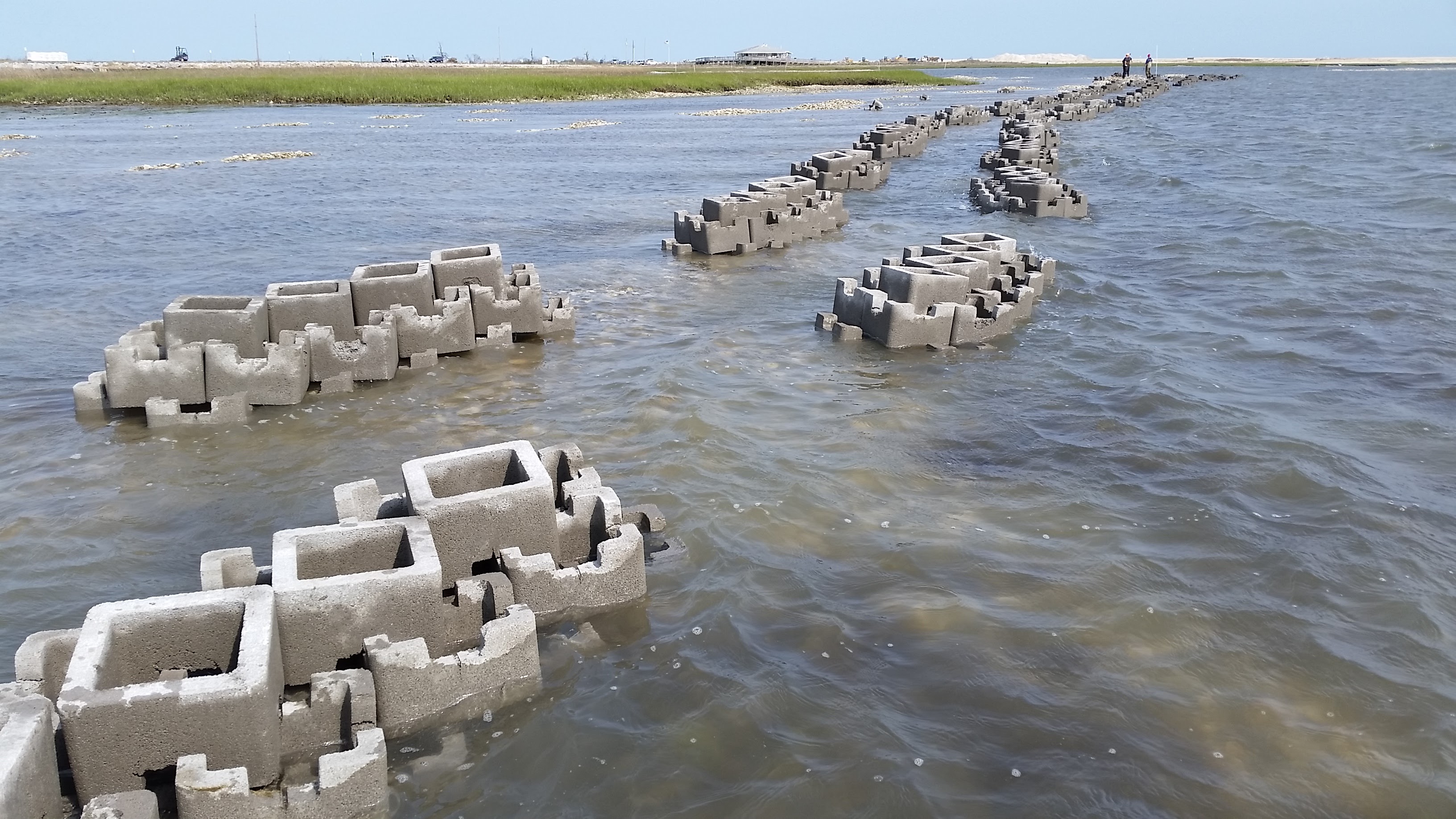
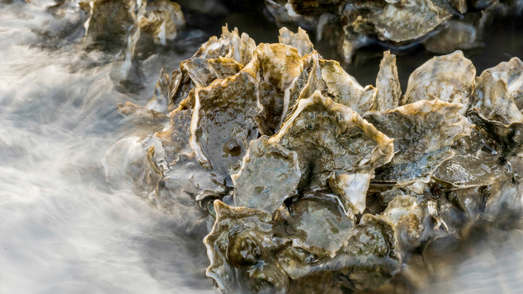
Live oysters growing on oyster castles protecting salt marsh in the background at Box Tree Oyster Sanctuary. Photo credit: Bowdoin Lusk/The Nature Conservancy
The Eastern Shore Climate Adaptation Working Group is a consortium of local governments and organizations dedicated to the regional coordination of adaptation planning. It is coordinated by the Accomack-Northampton Planning District Commission. This working group has identified the following strategies to enhance resilience and aid in climate-related adaptation:
Reduce climate-related risks and enhance natural resilience. The Coastal Resilience approach is being implemented in the Eastern Shore of Virginia with stakeholder workshops and the development of the Coastal Resilience Mapping and Decision Support tool using local information. The novelty of this tool is that it enables identification of nature-based solutions like oyster and wetland restoration to mitigate risk and enhance resilience.
Demonstrate how healthy and restored coastal habits are cost-effective ways of increasing the resilience of coastal communities. Coastal habitats are being restored and through specific demonstration projects, the efficacy of these habitats in reducing destructive wave energy is being studied. Read our latest post on making the case for nature-based solutions in Virginia’s coastal bays: Quantifying the wave-dampening effects of restored oyster reefs on eroding shorelines.

Building oyster castles at Boxtree Farm. Photo Credit: Bo Lusk/The Nature Conservancy
Educate local stakeholders and communities about climate change, natural infrastructure, and adaptation decision support tools. The Eastern Shore community is being engaged on how to adapt to conditions that threaten their homes, livelihoods, and way of life is mission critical as is translating research, data and science into usable information for local decision-making via the Coastal Resilience tool, forums, and other arenas for public education. View latest workshop materials and outcomes here: Coastal Resilience tool workshop for the Eastern Shore of Virginia
Related Stories and News
Coastal Resilience Tool Featured on Virginia’s Public Radio
Virginia Coast Reserve director Jill Bieri was interviewed by Sandy Hausman on WVTF/Radio IQ about the Virginia Eastern Shore Coastal Resilience tool.
Virginia Eastern Shore Future Habitat App Updated
The Future Habitat app, which shows how the size and distribution of tidal marshes and other coastal habitats may change in response to future projected sea-level rise scenarios on Virginia’s Eastern Shore, has been updated.
CR tool featured in Smithsonian traveling exhibition
The Virginia Eastern Shore Coastal Resilience tool will be featured in “Water/Ways”, a Smithsonian Traveling Exhibition that explores water’s historical, environmental and cultural impact. The exhibition will be held at the Cape Charles Museum and Welcome...
Communicating Virginia Coastal Resilience Science
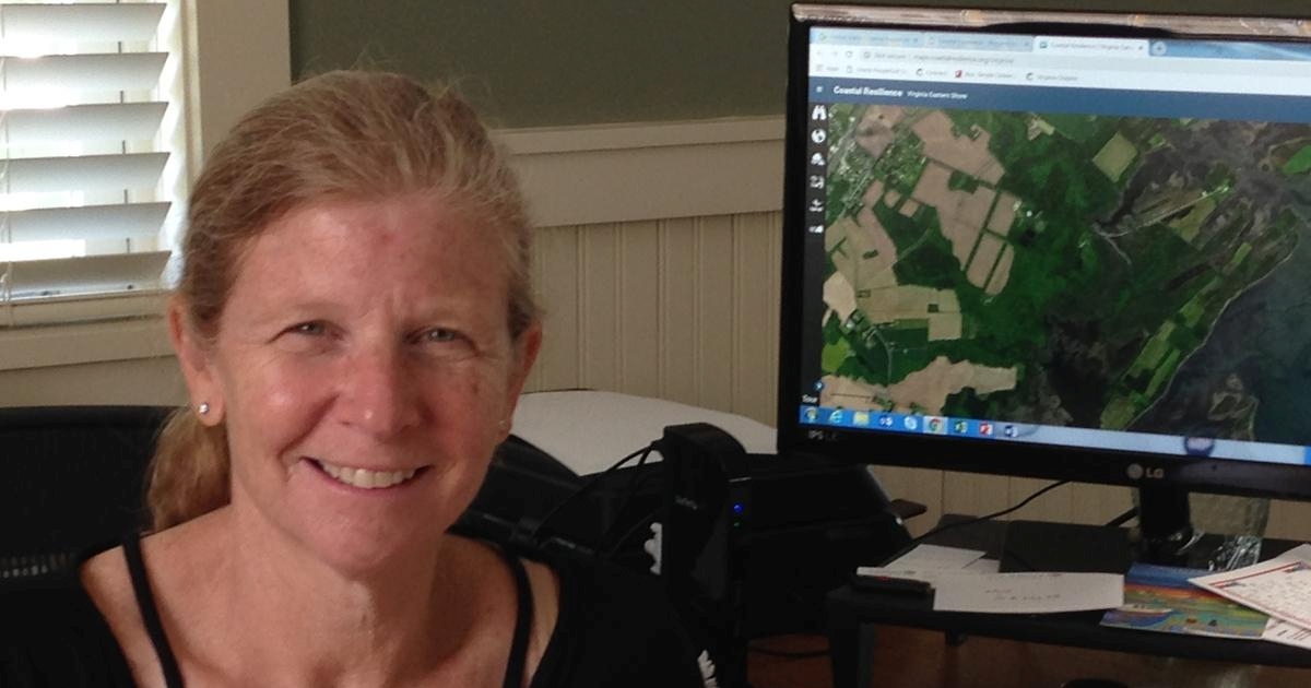
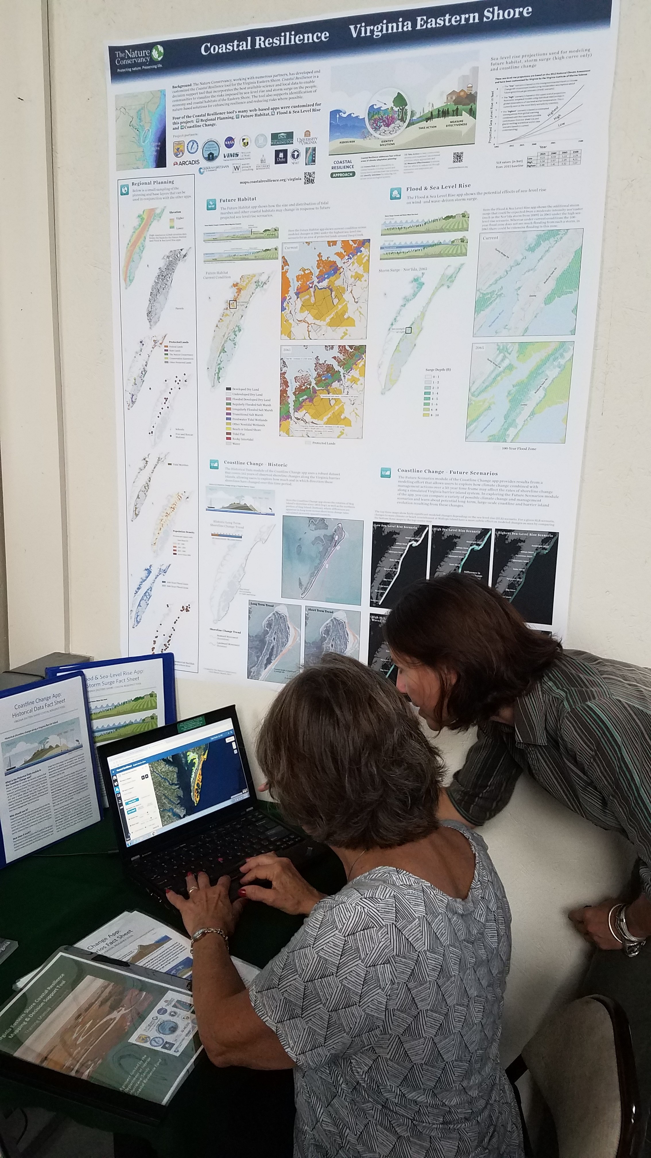
Chris Bruce, the GIS Manager for TNC Virginia, and Amy Ferguson, an M.S. Candidate at University of Virginia, recently presented award-winning posters that document the study sites, field methods, data analysis, and finally some results that are incorporated into various Coastal Resilience applications specific to Virginia’s eastern shore.
Eastern Shore communities confront changes brought on by sea level rise and stronger storms
The Virginian Pilot highlights the work that TNC and partners’ have been engaging in to model both the historic trends of and future projections for the eastern shore barrier islands.
Big Problem, big data
Groundbreaking apps aim to put Eastern Shore a step ahead of sea level rise.
People Behind a Stronger Coast: Kevin Holocomb and Amy Ferguson
“People behind a Stronger Coast” has been re-posted from the US Fish and Wildlife Service, where the original post can be found on their website called Building a Stronger Coast: https://www.fws.gov/hurricane/sandy/index.cfm More frequent storms surges have...
New Oyster Reefs at Chincoteague National Wildlife Refuge to Help Protect Coastlines
Volunteers Do the Heavy Lifting to Build “Oyster Castles” for Living Shoreline Project To better protect shorelines in the Chincoteague National Wildlife Refuge (NWR), two oyster reef living shoreline projects are being constructed in refuge waters by the U.S....
Making the Case for Nature
Making the case for nature-based solutions in Virginia’s coastal bays: Quantifying the wave-dampening effects of restored oyster reefs on eroding shorelines The Nature Conservancy is working with partners and leading coastal scientists to better understand how we can...
Virginia Eastern Shore Planning for a Changing Coast
Creating More Resilient Coastlines on Virginia’s Eastern Shore: A new tool is helping Virginia Eastern Shore communities plan for a changing coast Picture a place along the Eastern Shore of Virginia that you love. Do you fish there? Plant clams there? Go kayaking,...
Coastal Resilience Tool Embraced by Local Planning District Commission
In a recent interview, Curt Smith, Director of Planning for Accomack-County Planning District Commission (A-NPDC) spoke about how A-NPDC is using the Coastal Resilience tool to plan for rising seas and coastal flooding.
The iPlover Project
An innovative app is helping enhance habitat resilience for beach-nesting shorebirds in the face of sea-level rise.
Resources
- Virginia Coastal Resilience Training Materials
- The Virginia Coast Reserve: An Introduction
- Effects of Global of Climate Change at the Virginia Coast Reserve: Report from the Virginia Coast Reserve Climate Change Threats Workshop (2011)
- The Eastern Shore of Virginia: Strategies for Adapting to Climate Change: Report from the Eastern Shore Climate Adaptation Strategies Workshop (2011)
- Enhancing Coastal Resilience on Virginia’s Eastern Shore: A National Fish and Wildlife Foundation/Department of Interior Project
- Enhancing Coastal Resilience on Virginia’s Eastern Shore: Community Leader Workshop
Partners
Accomack-Northampton Planning District Commission – University of Virginia’s Long-Term Ecological Research Project – Virginia Institute of Marine Science’s Center for Coastal Resource Management – University of North Carolina at Chapel Hill – Randolph-Macon College – Duke University – University of North Carolina-Wilmington – Natural Capital Project – The Brosnan Center for Risk Reduction – NASA-Wallops Flight Facility – U.S. Fish and Wildlife Service Chincoteague National Wildlife Refuge – ARCADIS US, Inc. – Warren-Pinnacle Consulting, Inc.