New Jersey
The Nature Conservancy in New Jersey is partnering with local communities to develop a suite of tools and projects that incorporate “nature-based solutions” into coastal management decisions. These solutions, which use native vegetation, wetlands, dunes, and reefs among other features, help to protect communities from coastal hazards like sea level rise, shoreline erosion, and nuisance flooding, while also enhancing habitats, and providing ecosystem service benefits for both people and nature.
Banner photo: Jim Wright/LightHawk
Overview
Today, New Jersey faces a changing climate, specifically accelerating sea level rise and more frequent and intense coastal storms. These challenges, and others, place both coastal habitats and communities at risk. Storms like Superstorm Sandy and Hurricane Irene have brought attention to the need to increase the resiliency of our coastal communities. Superstorm Sandy resulted in over $50 billion in damage, with more than half—$37 billion—in New Jersey. New Jersey is considered a hot spot for sea level rise, and nuisance flooding.
Federal, state, and local governments along with residents, face difficult choices on how best to manage an ever-changing coast. To reduce risk for coastal communities, proper planning and tools are needed to make better policy, management, and conservation decisions for the benefit of people and nature.

Coastal destruction caused by Hurricane Sandy storm surge along the New Jersey Shore. Photo credit: Bridget Besaw
Coastal Resilience Tool-kit
The Nature Conservancy and its partners have developed a collection of web-based tools that empower communities to identify nature-based solutions to coastal hazards. Applications such as the Restoration Explorer and Future Habitat, allow users to visualize current and future conditions and explore a range of options for addressing coastal hazards in a way that also promotes healthy coastal habitats.
Restoration Explorer
The Restoration Explorer is a web-based decision support tool, that empowers communities to visualize what types of “Living Shoreline” techniques may be appropriate at a given location along the coast. Living Shorelines are an alternative approach to shoreline stabilization, using natural elements like native vegetation, dunes, and oyster reefs to buffer the shoreline from the effects of waves and currents, while maintaining the inter tidal connection between land and water. Traditional shoreline protection techniques like bulkheads and sea-walls (so-called hardened shorelines) reflect wave energy into the surrounding environment causing scour and damage to aquatic habitats. As more and more of our shoreline becomes “hardened”, these habitats eventually disappear, along with the benefits they provide.
The Restoration Explorer combines engineering criteria developed by The Stevens Institute of Technology and geo-spatial data on current shoreline conditions from Rutgers University, to help communities visualize where a living shoreline project may be appropriate. For more info on how to use the Restoration Explorer check out the User Guide, which contains step-by-step instructions on how it works. You can also view a short video tutorial here.
Shoreline enhancement projects have a variety of ecological and engineering requirements and can often be mixed and matched to tailor project designs to local conditions. At times, they can also be combined with more traditional hardened structures. It is important to consult with ecologists and engineers to determine the specific design requirements for any proposed project. It is also important to consult with Federal, State, and local officials regarding permitting requirements.
Future Habitat App
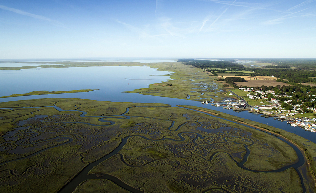
Habitats like salt marshes have the ability to move further inland as sea-level rises. This depends on several factors including: the amount of sediment accumulating on the marsh, the rate of sea level rise, and whether or not there are physical obstacles preventing wetlands from moving inland. By depicting various tidal marsh advancement scenarios, the Future Habitat App allows communities to better understand where marshes may be lost in the future.
Resources
For the latest reports, papers and other publications on coastal resilience in New Jersey visit the Coastal Resilience Resource Library on the Conservation Gateway. Click here to be redirected to the Resource Library for the latest reports, papers and other publications on coastal resilience in New Jersey.
- New Jersey Coastal Resilience Mapping and Decision Support Tool
- A Community Resource Guide for Planning Living Shorelines Projects. The Nature Conservancy, New Jersey Chapter. Delmont, NJ. (2019)
- A Guide for Incorporating Ecosystem Service Valuation into Coastal Restoration Projects. Schuster, E. and Doerr, P.The Nature Conservancy, New Jersey Chapter. Delmont, NJ. (2015)
- Lower Cape May Meadows Ecological Restoration: Analysis of Economic and Social Benefits. Schuster, E. The Nature Conservancy, New Jersey Chapter. Delmont, NJ.(2014)
Ecosystem Services of South Cape May Meadows
The South Cape May Meadows project, completed in 2007, included restoring the beach, dune, and wetland as well as installing a water management system. To show how important it has been, we completed an economic study of the South Cape May Meadows restoration and our results uniquely provide data showing that nature has real value. That value comes in the form of flooding protection in Cape May Point, which will be at least $2,000,000 and could be as high as $17,300,000 in damages avoided to homes over the next 50 years. Even more, given that it restored prime habitat for migratory birds, South Cape May Meadows also brings in an estimated $313 million in additional revenue each year from birders visiting the area. The South Cape May Meadows restoration reinforces that healthy natural landscapes benefit our communities in many ways, including financially, and that investing in nature pays off.

Links to relevant Cool Green Science Blogs
http://blog.nature.org/science/2014/08/14/ecological-restoration-coastal-nature-flooding-resilience/
Gandy’s Beach Oyster Reef Breakwater
Natural features, like oyster reefs, can play an important role for coastal communities that are dealing with challenges like storm-related erosion and flooding. We’ve teamed up with the U.S. Fish and Wildlife Service, Partnership for the Delaware Estuary and Rutgers University Haskin Shellfish Research Lab to install a living shoreline consisting of an oyster reef breakwater at TNC’s Gandy’s Beach Preserve along the Delaware Bay. The project involves planning, engineering, construction, and monitoring of nearly 3,000 feet of oyster reef to help reduce local erosion problems and enhance habitat for species like horseshoe crabs and red knots.
The reef was constructed from a combination of materials, including “oyster castles,” stackable, interlocking blocks of concrete that encourage oysters to attach and grow, as well as bagged oyster shells collected as part of a shell recycling program with Dock’s Oyster House in Atlantic City.

Installation of oyster castles at Gandy’s Beach, March, 2016. Photo Credit: Patricia Doerr
The oyster reef breakwaters provide a multitude of benefits, including filtering water, providing habitat for commercial and recreational fisheries, and reducing the energy of waves as they move towards shore, which means less erosion for the coastline. The benefits will continue to grow as the oyster reef becomes “self-sustaining,” meaning it will continue to grow each year as oyster larvae settle and mature. New oysters will attach and grow on our reefs, building the population of oysters at the site for years.
Partners
The Nature Conservancy in New Jersey recently lead the NJ Resilient Coastlines Initiative, a NOAA-funded project aimed at building the resilience of New Jersey’s coastal habitats. A major milestone of this project was to introduce the Restoration Explorer Application on the Coastal Resilience mapping tool. The Restoration Explorer has allowed the Conservancy and its partners to work with communities to identify what types of shoreline enhancement projects will work where based on engineering criteria and on-the-ground conditions. Project partners and collaborators include:


