
Maryland
Maryland is already experiencing the impacts of a changing climate: dramatic nuisance flooding is commonplace along the coast, and agricultural fields on the Eastern Shore are increasingly struggling to deal with saltwater intrusion. Thankfully, nature can help. Coastal habitats, especially marshes and forests, play a significant role in reducing risk along Maryland’s shoreline. According to a recent study, Maryland’s wetlands reduced damages from Hurricane Sandy by nearly 30% — that’s over $40 million dollars saved in avoided damages. For more information on the analysis, conducted in partnership by The Nature Conservancy, Lloyds of London, Wildlife Conservation Society, and UC Santa Cruz, click here.

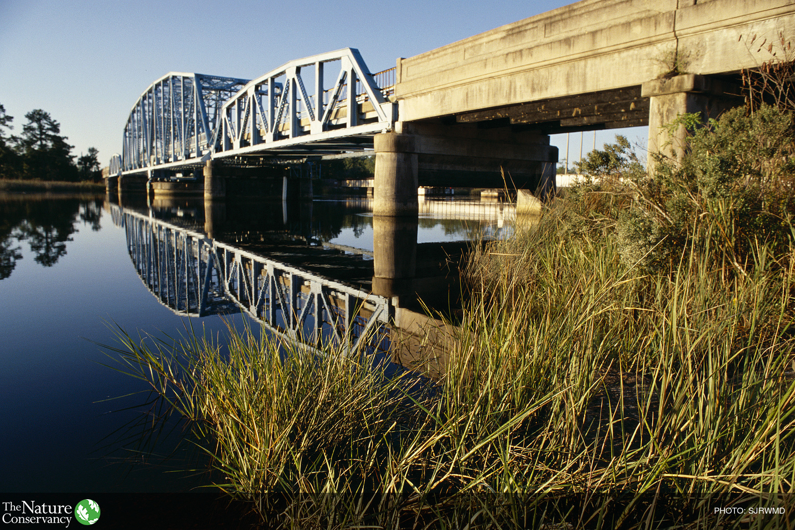
Marshes on Maryland’s Eastern Shore. Photo Credit: Kelly Leo (TNC)

Marshes on Maryland’s Eastern Shore. Photo Credit: Kelly Leo (TNC)
Overview
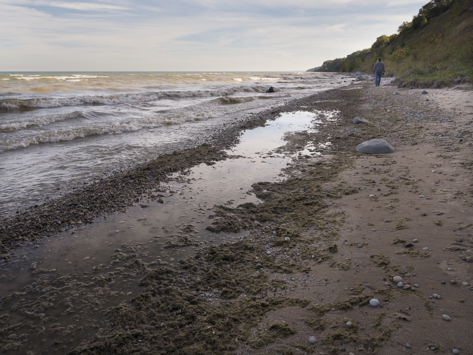
With over 7,700 miles of shoreline, Maryland is one of the most vulnerable states to the effects of coastal flooding and erosion. Maryland’s Eastern Shore is the third most vulnerable region in the country after the Mississippi Delta and South Florida due to a combination of high rates of localized sea level rise and high rates of regional land subsidence – a natural geologic phenomena. Over the last century, Maryland has already witnessed over a foot of sea level rise, the impacts of which can be seen regularly on the ground in the form of increasingly frequent and dramatic nuisance flooding of roads and coastal properties, marsh loss, saltwater intrusion onto the edges of coastal agricultural fields, and through illustrative ghost forests – coastal forests dying in place as salt waters take over.
Socioeconomic

As sea levels rise, agricultural fields are being inundated with salt water on the Eastern Shore of Maryland. Photo Credit: Severn Smith (TNC)
Marshes trap nutrients before they get into Chesapeake Bay, improving local water quality and providing critical nursery habitat for commercially and recreationally important fish and seafood species. Unless we act now to protect against dramatic marsh loss, Maryland’s seafood industry will once again be at risk.
Farmers across the Eastern Shore are already experiencing the impacts of saltwater intrusion on lower-lying edges of their agricultural fields. While the dynamics of saltwater intrusion are complex, its projected area of impact is only expected to increase, constraining arable lands and making it harder for farmers to make ends meet.
Climate change does not impact everyone equally. Some areas are more vulnerable than others, and some communities have resources in place that naturally make them more resilient in the face of frequent flooding and erosion. According to Maryland’s Coastal Resiliency Assessment, some of the most at-risk areas can be found in Dorchester, Somerset, and Worcester Counties. The Conservancy is beginning to work with these communities to identify ways that nature can help them become – naturally – more resilient.
Habitats and Species

Ghost Forest at TNC’s Robinson Neck Preserve, MD. Photo Credit: Kelly Leo
The Maryland Department of Natural Resources estimates that we could lose as much as 90% of our coastal marshes by 2100 to a combination of over three feet of projected sea level rise and localized land subsidence. In some of the more vulnerable places, like Blackwater National Wildlife Refuge located on the lower Eastern Shore in Dorchester County, we have already seen dramatic marsh loss in the last century of up to 5,000 acres. Thankfully, scientists and managers are also noting that nearly 3,000 acres of marshes have emerged at upland edges. But managing for wetland migration may come at a cost – as we lose ground, we need to make touch choices about how to use the lands that remain: do we manage upland areas for coastal forests, which are some of the most effective habitats for reducing flood impacts and risks to communities are losing ground to marshes? Or do we allow marshes to take them over, as visualized by the dramatic ghost forests seen along much of the Eastern Shore.
Marshes are important nursery habitats for fin and shellfish, but also provide critical nesting habitat for a variety of shorebirds. 90% marsh loss would have crippling and cascading impacts throughout our coastal ecosystems.

Ghost Forest at Assateauge Island National Seashore. Photo Credit: Kelly Leo
Overview

Deal Island, the site of a wave attenuation study on Maryland’s Eastern Shore – a partnership between The Nature Conservancy, George Mason University, and the MD Department of Natural Resources. Photo Credit: Kelly Leo (TNC)
Evaluating the effectiveness of Eastern Shore tidal wetlands for storm risk reduction in the Chesapeake Bay
Coastal wetlands are known for their importance for biodiversity and as natural defenses against waves, erosion and storm surge. A lot of work has been done globally to document the risk reduction value of mangroves and coral reefs but, to-date, there is little to no robust work that quantifies the benefits of wetland habitats in Maryland along the Chesapeake Bay.
To help fill in this gap, the Maryland/DC Chapter of The Nature Conservancy, George Mason University and Maryland’s Department of Natural Resources are partnering to better understand the effectiveness the Eastern Shore’s natural tidal wetlands to reduce the impacts of wave energy. This project will measure the hydrodynamics of storm surge and waves inside Maryland’s marshes and the attenuation of waves and currents. The results will indicate the capacity of coastal wetlands and marshes to absorb tidal flooding and reduce wave energy and impact reducing storm surges.
The first field site selected for this study is the future site of the Department of Natural Resources’ shoreline dune restoration project: the marsh just south of Soundside Estate Road. The scientists from George Mason University will begin installing monitoring devices in the marsh in May 2018.

Wave Attenuation Study Team selecting the field site on Maryland’s Eastern Shore – a partnership between The Nature Conservancy, George Mason University, and the MD Department of Natural Resources. Photo Credit: Kelly Leo (TNC)
Maryland’s Coastal Resiliency Assessment
The Nature Conservancy partnered with the Maryland Department of Natural Resources to conduct a Coastal Resiliency Assessment aimed at understanding how the habitats, hazards, and people across Maryland’s coastlines intersect and identifying priority areas for protection and restoration where nature can help communities become more resilient. The Assessment is being used to guide land protection opportunities to promote the resilience of natural and human communities across our coastline.
Protecting Wetland Adaptation Areas
The Nature Conservancy has been working to protect biodiversity hotspots in the Nanticoke watershed for decades. Thousands of acres of habitat that we have helped to protect are now known to be important wetland adaptation areas. The Conservancy is working to ensure that these areas are best managed to allow for marsh migration in response to changing coastal conditions. We recently submitted a proposal to expand the Nanticoke Rural Legacy Area to make it even easier to protect greater expanses of wetland adaptation areas in the region.
Resources
For the latest reports, publications and other resources on coastal resilience in Maryland visit the Coastal Resilience Resource Library on the Conservation Gateway.
Related Stories and News
Green vs. Gray: A Cost-Benefit Analysis
Investments in coastal gray infrastructure such as roads and bridges far outstrip the funding for green infrastructure such as wetlands and reefs, but a more balanced investment portfolio could prevent billions of dollars of storm damage, according to a study.
Assessing our Coastal Green Infrastructure Investment Allocation
TNC scientists assess how much money is invested in varying types of coastal green infrastructure and found that we spend 30 times more on gray infrastructure than on conservation. Imagine if we invested just one tenth of the infrastructure funds on conservation and restoration.
Network Member of the Month: Charles Lester
Charles Lester has been working in the California coastal management community for over 20 years, most recently as the executive director of the California Coastal Commission. He is currently a researcher at the Institute for Marine Sciences at UC Santa Cruz.
The Threats and Opportunities of Climate Change
Join us on a journey through Washington’s ecosystems, to find out how climate-change impacts each individually — as well as comprehensively. By understanding how our landscapes, neighborhoods and climate are all connected, we can better forge our own connections to adapt together.
Let Nature be the Guide to Shore Up our Coasts
Washington has more than 2,300 miles of coastline that sustain communities, livelihoods, recreation and diverse ecosystems. Though robust, our coasts are especially vulnerable to climate-change impacts, including flooding, sea-level rise, increased erosion and others.
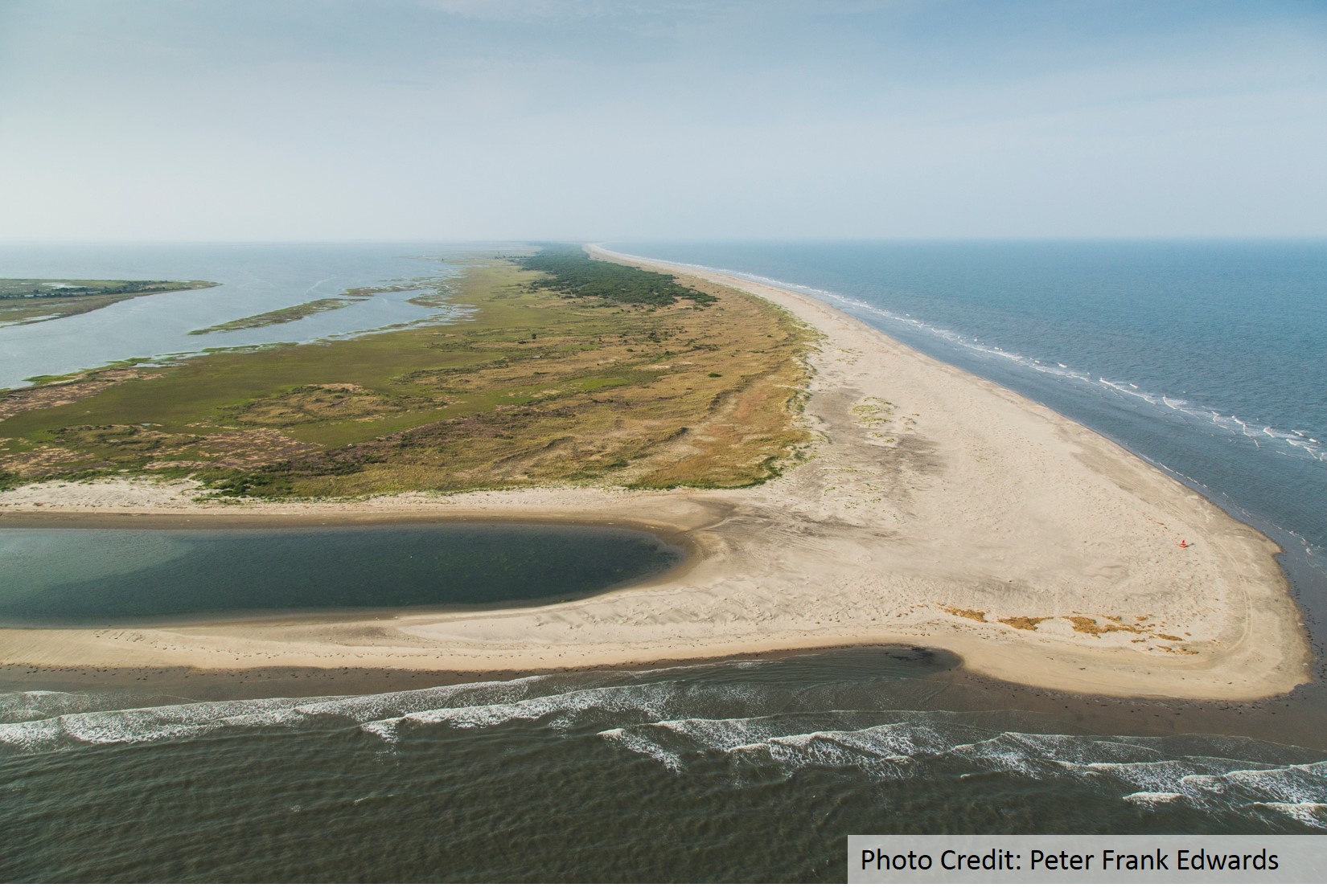
Eastern Shore communities confront changes brought on by sea level rise and stronger storms
The Virginian Pilot highlights the work that TNC and partners’ have been engaging in to model both the historic trends of and future projections for the eastern shore barrier islands.
Restoration Explorer focuses on oysters
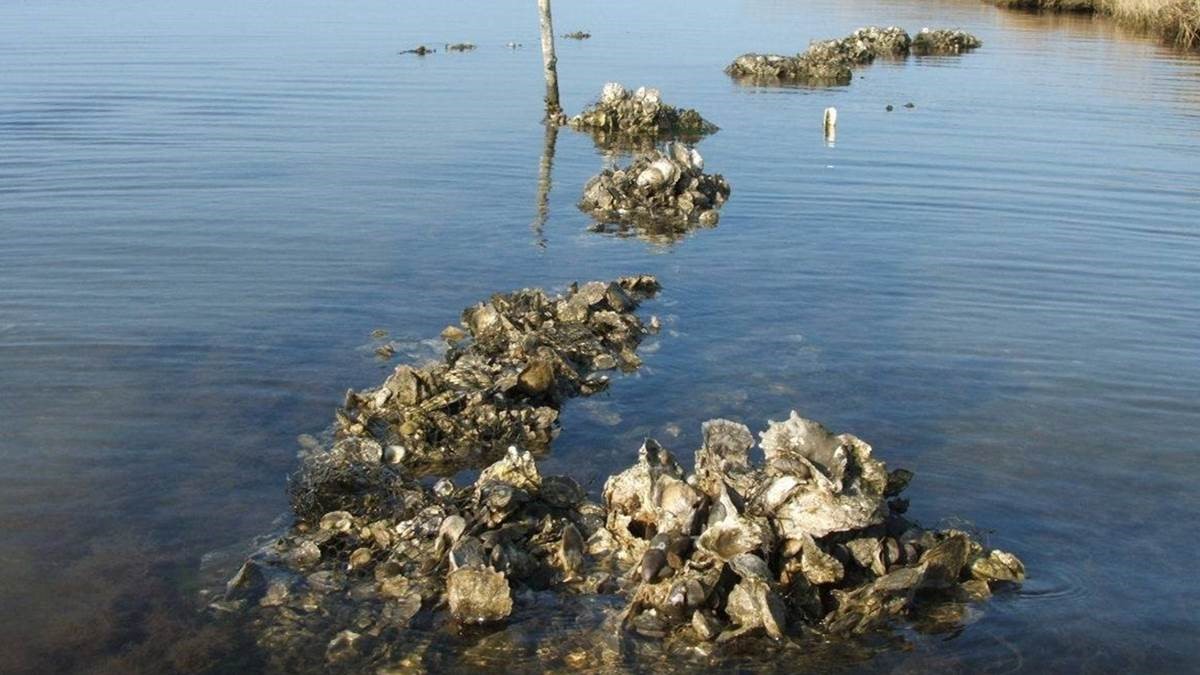
The Nature Conservancy has expanded its efforts to restore oysters by incorporating new data into a computer application that helps coastal managers map areas that are suitable for oyster reef restoration.

CRS back in action at Coastal GeoTools 2017!
Digital Coast partners teamed up with Climate Central to share their progress on the development of tools and resources to help communities increase their Community Rating System (CRS) credits at Coastal GeoTools 2017.