Flood and Sea Level Rise
What is the Flood and Sea Level Rise app?
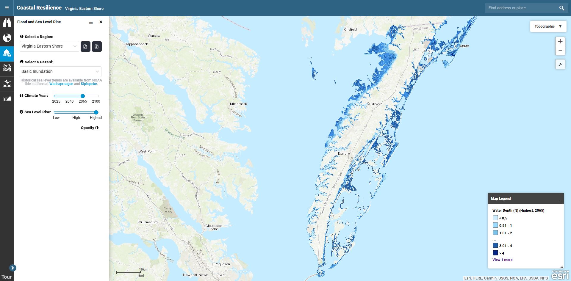
![]() The Flood and Sea Level Rise App allows users to view areas that may be affected by flooding under current and multiple future scenarios from sea level rise, surge from storms and hurricanes, and floodplain inundation.
The Flood and Sea Level Rise App allows users to view areas that may be affected by flooding under current and multiple future scenarios from sea level rise, surge from storms and hurricanes, and floodplain inundation.
This app is being used in all Coastal Resilience geographies. Launch mapping portal.