Community Rating System Explorer
What is the Community Rating System Explorer app?
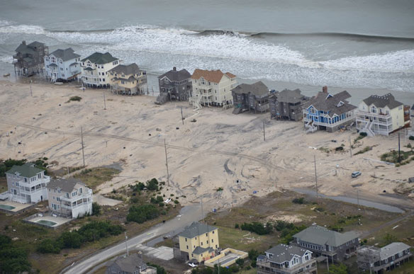
![]() The Community Rating System Explorer (CRS Explorer) is an app that helps planners identify areas that are eligible for Open Space Preservation (OSP) credits in FEMA’s Community Rating System (CRS). FEMA’s CRS is a voluntary program that encourages communities to earn a discount on flood insurance premiums for actions that contribute to their flood risk reduction.
The Community Rating System Explorer (CRS Explorer) is an app that helps planners identify areas that are eligible for Open Space Preservation (OSP) credits in FEMA’s Community Rating System (CRS). FEMA’s CRS is a voluntary program that encourages communities to earn a discount on flood insurance premiums for actions that contribute to their flood risk reduction.
This tool provides exportable information to support the application process and allows communities to interactively explore their data to identify future open space which would further reduce flood risk and premiums.

Although the CRS program rewards a vast number of activities, the volume of information, data, and maps required to calculate and apply for points can be overwhelming for some communities that don’t have the time or Geographic Information Systems (GIS) capacity to take full advantage of the program. The CRS Explorer helps communities maximize their Activity 420 Open Space Preservation (OSP) credits and explore the value of protecting land in the floodplain to reduce flood risk. Preserving open space allows the land to retain its natural function in the floodplain, storing floodwaters and reducing flashiness, as well as provide benefits to the ecosystem and water quality.
Main functions:
- Determines areas that currently qualify for Open Space Preservation (OSP) credit and calculates the points they provide.
- Provides exportable, preprocessed maps and analysis information to support the CRS application process.
- Assists with identifying future open space in the floodplain.
- Can serve as a flood risk communication piece for residents and decision-makers
Who should use it?
County and City Planners
Planners and managers that are interested in lowering their flood insurance premiums by participating in the NFIP CRS program.
Floodplain Managers
Public officials and managers that want to educate their communities about how to improve floodplain management and reduce risk to flooding.

TNC CRS Workshop 8.25.16
How does it work?
FEMA Digital Insurance Flood Rate Maps (DFIRMS) are used alongside parcel and land use data, imagery, building footprints, impervious surface information, hydrological features, and regulatory zones including setback areas, natural areas (preserves, parks, managed open space) and heritage sites. Communities incorporate their parcel and tax data using a model builder product which formats the data for CRS Explorer. Javascript code and companion guidance document are available in a GitHub repository and are licensed as open source materials under a GNU General Public License.

CRS Explorer analyzes data sets to determine areas that currently qualify for OSP credit and calculates the points they provide.
How are the future parcels identified that could potentially get CRS credit?
Communities identify undeveloped parcels within their dataset through zoning, land class/use code or other indicator within their data. They run the ArcToolbox Model to format their data for CRS Explorer and identify their Future OSP input values. CRS Explorer analyzes the inputs and populates a table that the user queries by Acres or Tax Value.

CRS Explorer filters community data to identify areas for future OSP credit.
What are the strengths and limitations?
App Strengths:
- The app quantifies and evaluates the total CRS credits available by each element within the 420 Open Space Preservation.
- The app shows parcel-level information and provides pre-processed maps that can be submitted along with a CRS application.
- The app can be overlaid with socioeconomic and ecological data layers to make a stronger case to include parcels that aren’t currently eligible for CRS credit into a future application.
- The functionality of the app allows it to be easily applied to other geographies that have parcel data.
- The app is easy to use by planners.
App Limitations:
- The app estimates potential credits. It is based on best available data, but does not represent a final analysis or score, and must be verified by the NFIP’s CRS Insurance Service Office (ISO) representative.
- It only identifies areas eligible for the CRS Activity 420 OSP elements, it is the responsibility of the applicant to determine other points the community could receive in other activity and element categories.
- The quality of the resulting analysis is dependent upon the data provided by the community; communities are responsible for acquiring data, running the ArcToolbox Model, and validating the outputs inputs.
Where is it being used?
The CRS Explorer is based off an idea that a county planner in North Carolina had during collaboration with the TNC state chapter. It was piloted in two counties, Dare and Hyde County, and eight communities. In 2014, stakeholders prioritized the need to better understand the National Flood Insurance Program (NFIP) to more effectively reduce their community’s insurance premiums.
Across the eight pilot communities in Dare and Hyde counties, an average of 546 currently eligible OSP points were identified. Assuming all points are validated and received, these additional credits would be enough to promote each community at least one CRS Class, which would result in a larger NFIP discount for the community and would contribute to mainstreaming this nature-based approach in other communities.
Who helped develop it?
- CRS Insurance Services Office (ISO).
- FEMA Mapping team.
- Dare County provided guidance on the development of the app.
- Communities in North Carolina: