• Twitter
  • RSS
  • Contact Us
Coastal Resilience
  • About
    • Ten Years of Coastal Resilience
    • Team and Partners
    • Terms of Use
  • Natural Solutions
    • Approach
      • Assess
      • Identify
      • Action
      • Measure
    • Toolkit
  • Collaborations
    • Accounting for Nature
    • AI for Conservation
    • Nature and Insurance
    • Open Space
    • Nature in Humanitarian Cycle
  • Projects
    • Australia
      • Victoria
      • Western Australia
    • Caribbean
      • República Dominicana
      • Grenada and St Vincent and the Grenadines
        • At the Waters Edge
        • Grenada Resilient Islands
      • Jamaica
      • Resilient Islands
      • U.S. Virgin Islands
    • Indonesia
    • United States
      • California
        • California Coastal Resilience Network
      • Connecticut
      • Georgia
      • Gulf of Mexico
      • Hawaii
      • Maine
      • New Jersey
      • New York
      • North Carolina
      • Northeast and Mid-Atlantic
      • Southeast Florida and the Florida Keys
      • Southeast U.S.
      • South Carolina
      • Virginia Eastern Shore
      • Washington
        • Puget Sound
        • Southwest Washington
    • Mexico and Central America
  • Tools
    • Apps
    • Training
  • Resources
    • Stories and News
    • Research Library
    • Related Projects
    • Fact Sheets
    • FAQs
  • Mapping Portal
Select Page
Restoration Explorer focuses on oysters

Restoration Explorer focuses on oysters

by Coastal Resilience | Mar 24, 2017 | North Carolina, Story

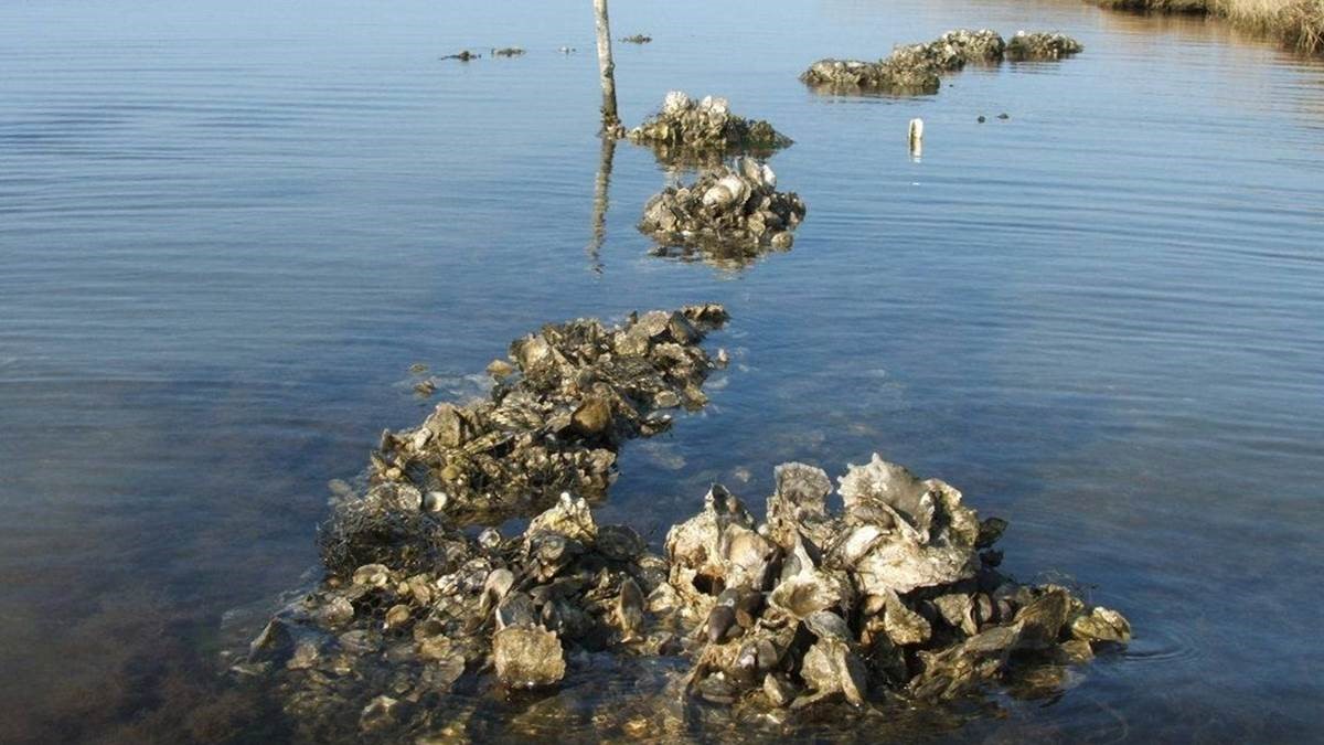
The Nature Conservancy has expanded its efforts to restore oysters by incorporating new data into a computer application that helps coastal managers map areas that are suitable for oyster reef restoration.

Reducing Property Loss With Open Spaces

Reducing Property Loss With Open Spaces

by Coastal Resilience | Oct 9, 2016 | North Carolina, Southeast Atlantic

Reducing Property Loss and Flood Insurance Premiums Through Open Space Preservation Contributed by Debbie Crane, Director of Communications for The Nature Conservancy, North Carolina When the Conservancy’s Kate Murray visited Dare County Planner Donna Creef, she came...
NEW North Carolina’s Community Rating System Explorer application

NEW North Carolina’s Community Rating System Explorer application

by Coastal Resilience | Sep 27, 2016 | North Carolina, Southeast Atlantic

North Carolina’s Community Rating System Explorer (CRS Explorer) assists a community by combining local data with high level mapping tools and calculations to help the community utilize the National Flood Insurance Program’s (NFIP) Community Rating System (CRS).

Next Entries »

About Coastal Resilience

Coastal Resilience is a global network of practitioners who are applying an approach and web-based mapping tool designed to help communities understand their vulnerability from coastal hazards, reduce their risk and determine the value of nature-based solutions.

RSS Our Latest on Twitter

  • Twitter
  • RSS

nature.org© 2021 The Nature Conservancy | Terms of Use | Privacy Statement