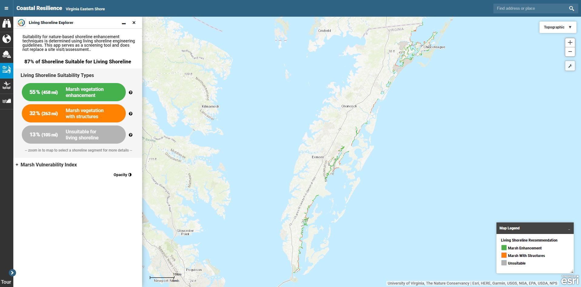
Living Shoreline Tutorial
Take this step-by-step tutorial to learn how to use the Living Shoreline app.

Take this step-by-step tutorial to learn how to use the Living Shoreline app.
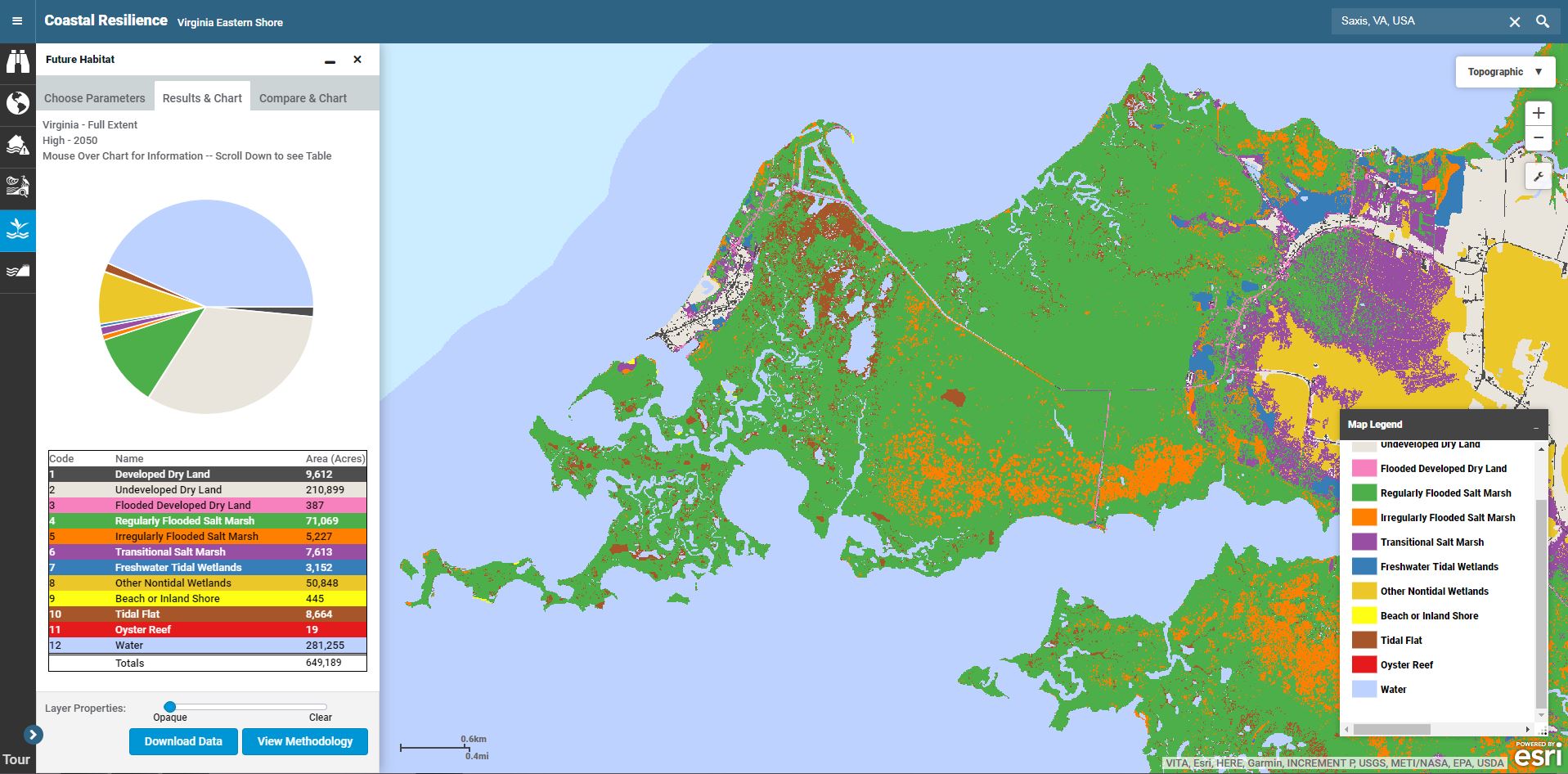
Take this step-by-step tutorial to learn how to use the Future Habitat app.
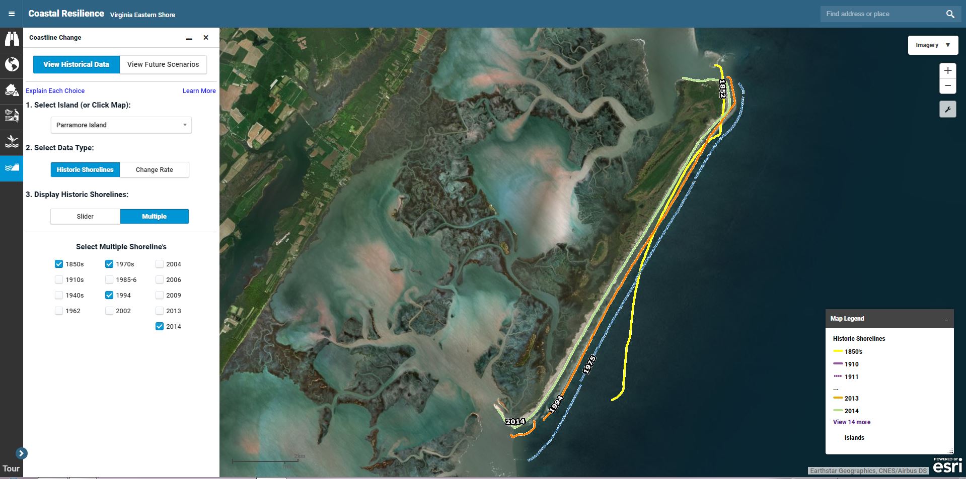
Take this step-by-step tutorial to learn how to use both the Historical Data and Future Scenarios modules of the Coastline Change app.
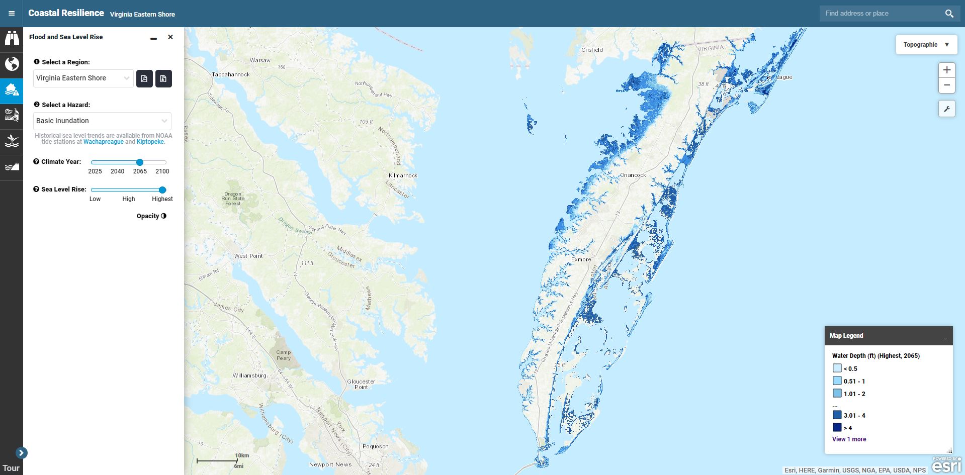
Take this step-by-step tutorial to learn how to use the Flood and Sea Level Rise app.
The Community Rating System Explorer helps planners identify areas that are eligible for Open Space Preservation (OSP) credits in FEMA’s Community Rating System (CRS), a voluntary program that encourages improved floodplain management through discounted flood insurance premiums, and provides exportable information to support the application process.